


Finding a home with easy access to public transit is a wonderful thing. In the United States, though, it’s rare. Less than 1 percent of homes for sale are located in what real estate company Redfin calls a “rider’s paradise.”
In addition to walkability, Redfin’s Walk Score website rates homes, cities and neighborhoods with Transit Scores that indicate the accessibility of public transit including buses, rail and light rail, subways and ferries.
In an earlier study, Redfin also looked at how transit affects property values. It analyzed roughly a million real estate transactions in 14 U.S. cities that occurred between January 2014 and April 2016 and concluded that each additional point of a Transit Score increased the price of a home by an average of $2,040, or 0.6 percent.
The Transit Score rankings interpret the point assignments this way:
- 90-100: Rider’s Paradise. World-class public transportation
- 78-89: Excellent Transit. Transit is convenient for most trips
- 50-69: Good Transit. Many nearby public transportation options
- 25-49: Some Transit. A few nearby public transportation options.
- 0-24: Minimal Transit. It is possible to get on a bus.
Here’s the ranking’s top 30 U.S. cities for public transit:
30. Rochester, New York

Transit Score: 43.2
Population: 210,565
29. Cincinnati, Ohio
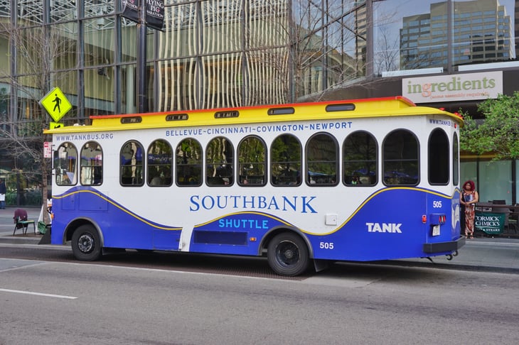
Transit Score: 43.6
Population: 296,943
The Southbank Shuttle, managed by the Transit Authority of Northern Kentucky, ferries residents and visitors back and forth across the Ohio River between Cincinnati and Newport on the Levee, a dining and attraction destination in Newport, Kentucky.
28. New Orleans, Louisiana

Transit Score: 44.2
Population: 343,829
27. St. Louis, Missouri

Transit Score: 45.2
Population: 319,294
Since 1949, the adjacent states of Missouri and Illinois, on either side of the Mississippi River, have jointly provided public transportation in the St. Louis region with service reaching some 200 cities and towns.
26. Santa Ana, California
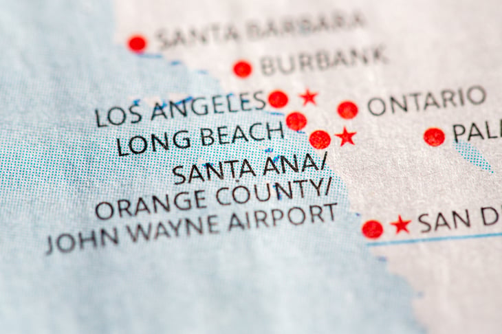
Transit Score: 45.5
Population: 324,528
25. Atlanta, Georgia
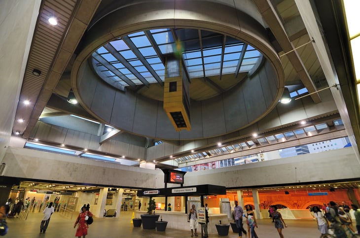
Transit Score: 46.0
Population: 420,003
The Five Points Station (above) is the Metropolitan Atlanta Rapid Transit Authority’s central hub.
24. Cleveland, Ohio
Transit Score: 47.1
Population: 396,815
Want to visit Cleveland’s Rock & Roll Hall of Fame? You can get there on an RTA Rapid Transit train. Hop off at the North Coast station (above).
23. St. Paul, Minnesota
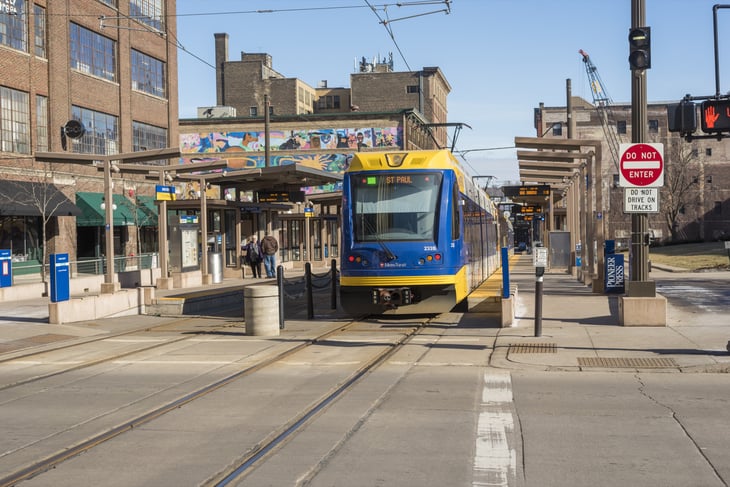
Transit Score: 47.4
Population: 285,068
St. Paul’s Metro transit carries people from one end of the city that abuts Minneapolis to the other.
22. Denver, Colorado
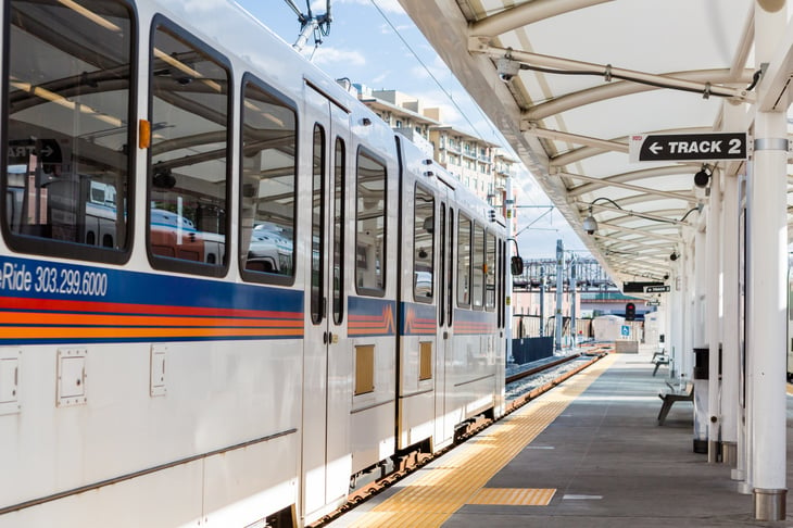
Transit Score: 47.8
Population: 600,158
Riders can go just about anywhere in Denver by bus or rail, says Denver.org, a trade association that markets the city. Union Station (above) is a downtown light rail stop.
21. Milwaukee, Wisconsin

Transit Score: 48.5
Population: 594,833
Milwaukee’s far-northern winter skyline includes icy Lake Michigan.
20. Buffalo, New York
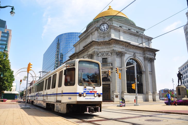
Transit Score: 49.5
Population: 261,310
A Buffalo Metro Rail train glides past the landmark 1899 Buffalo Savings Bank building.
19. Long Beach, California
Transit Score: 51.4
Population: 462,257
18. Portland, Oregon
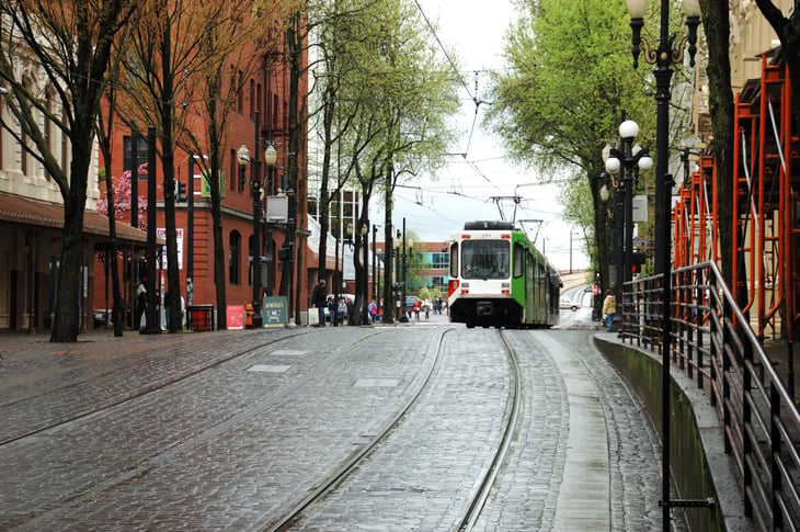
Transit Score: 51.4
Population: 583,776
Portland residents use a variety of transportation options, from the popular Max light rail to buses, commuter rail and streetcars like this one (above), near the city’s Burnside Bridge.
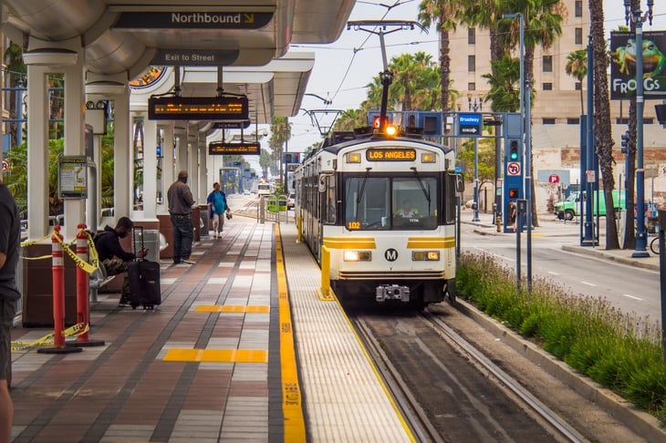
17. Los Angeles, California
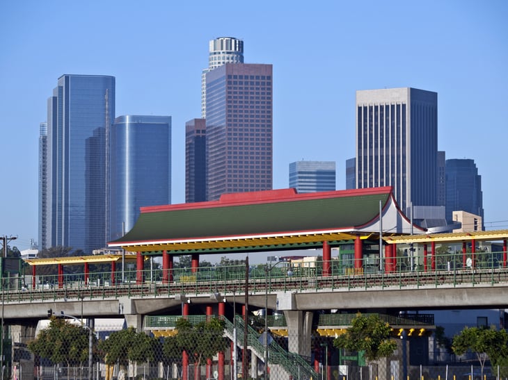
Transit Score: 51.5
Population: 3,792,621
Los Angeles is known for its freeways, but the city’s subways, light-rail, buses and shuttles reach “nearly every corner of the Greater Los Angeles area,” says the Los Angeles Tourism & Convention Board, which promotes Car Free L.A., a series of self-guided “car-free” vacation itineraries. Pictured above is the Chinatown light rail station.
16. Pittsburgh, Pennsylvania

Transit Score: 54.4
Population: 305,704
Pittsburgh’s historic Pennsylvania Station, finished in 1903, was the city’s railway hub for many years. It’s on the National Register of Historic Places, and today it is joined to a newer Amtrak station next door. A regional network of 10 transportation agencies links Pittsburgh and the 10-county Southwestern Pennsylvania region by train and bus.
15. Oakland, California

Transit Score: 56.3
Population: 390,724
The San Francisco Bay Area’s rapid transit trains, known as the BART system, serve Oakland, the East Bay communities and San Francisco.
14. Baltimore, Maryland
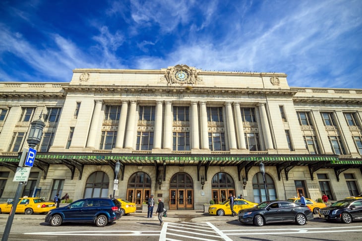
Transit Score: 57.2
Population: 620,961
Baltimore’s historic Penn Station is the hub for three services — Amtrack, MARC commuter trains and the Maryland Transit Administration’s light rail system.
13. Miami, Florida
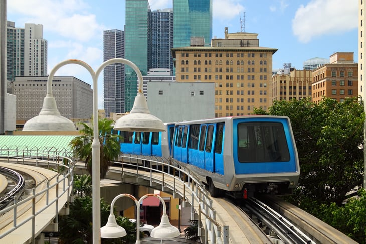
Transit Score: 57.2
Population: 399,457
You can get around Miami using buses and rail, including this automated downtown train system.
12. Honolulu, Hawaii
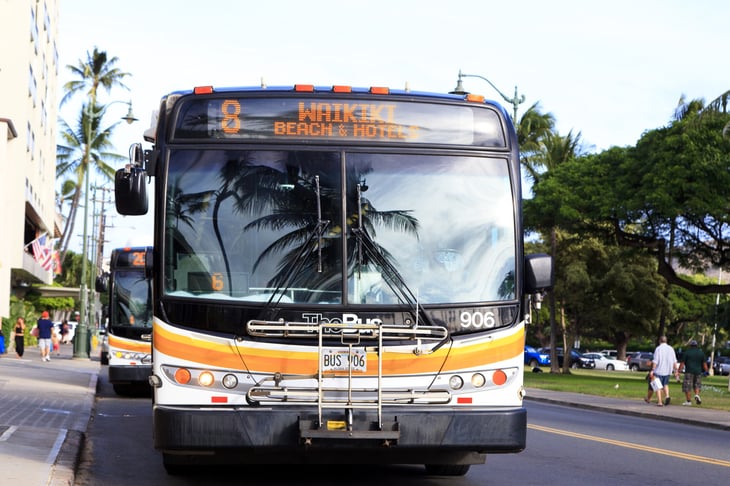
Transit Score: 57.2
Population: 337,256
TheBus carries residents and tourists around Honolulu and the rest of the island of Oahu.
11. Minneapolis, Minnesota

Transit Score: 57.6
Population: 382,578
Minneapolis’ hybrid electric buses are part of a commitment to cut emissions from vehicles.
10. Arlington, Virginia

Transit Score: 58.8
Population: 207,627
Despite the Washington, D.C., area’s famous gridlocked traffic, nearby Arlington is “a well-connected and transit-oriented county” where you can live “car-free” in many central neighborhoods, Redfin says.
It has a bike share program and enjoys access to the D.C.-regionwide Metro system of bus and rail as well as the local Arlington Transit, which uses natural gas buses to connect neighborhoods to Metrorail and operates cross-county routes.
9. Seattle, Washington
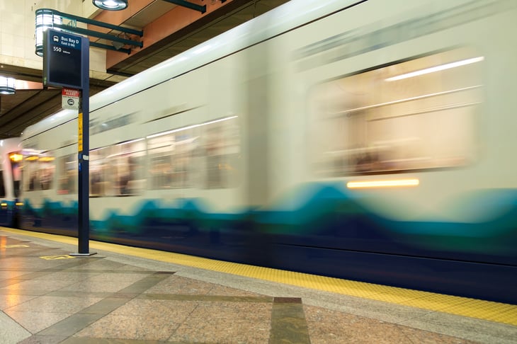
Transit Score: 59.6
Population: 608,660
Buses and trams, as well as a monorail dating to the 1962 World Fair, provide transport within the city. A new light rail system now connects travelers along a north-south axis, from one stop beyond Seattle-Tacoma International Airport (SEATAC) in the south, to the University of Washington on the northern side of Seattle, and it continues to expand.
8. Chicago, Illinois
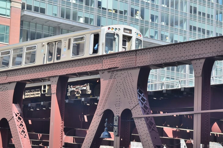
Transit Score: 65
Population: 2,695,598
Here, the Chicago Transit Authority’s famous Elevated Electric Train — or “The El” — crosses the Wells Street Bridge.
7. Newark, New Jersey
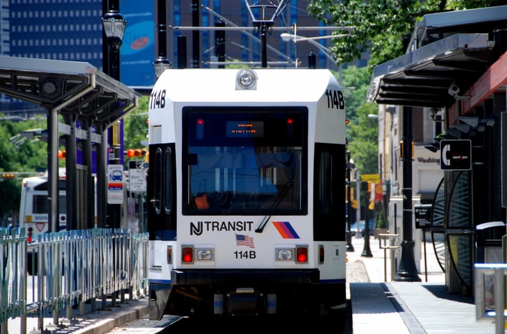
Transit Score: 65.2
Population: 277,140
NJ Transit light rail trolleys, including this one at Washington Park Station, are part of a complex system connecting Newark, surrounding New Jersey communities and New York City’s Penn Station.
6. Philadelphia, Pennsylvania

Transit Score: 66.8
Population: 1,526,006
5. Washington, D.C.
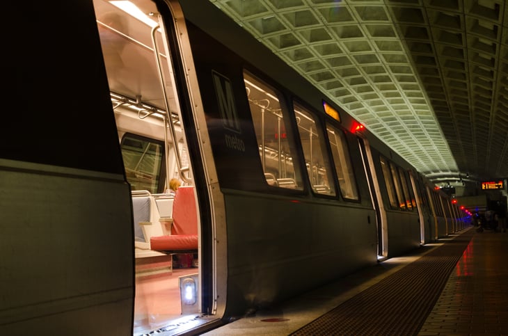
Transit Score: 68.5
Population: 601,723
Residents of Washington, D.C., and the surrounding suburbs use Metrorail and Metrobus to avoid the city’s legendary traffic gridlock. The Smithsonian Metro station is pictured above.
4. Jersey City, New Jersey

Transit Score: 70.6
Population: 247,597
Jersey City, New Jersey’s second-largest city (after Newark), has excellent public transportation. What’s more, residents can do most of their errands by foot, making it extremely “walkable.”
3. Boston, Massachusetts
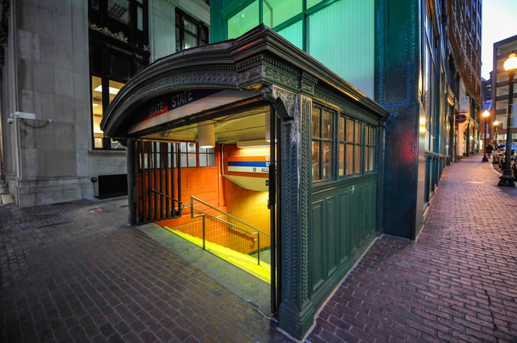
Transit Score: 72.6
Population: 617,594
One chapter in Boston’s long history of public transit is famously memorialized in a 1959 song, “MTA,” by the Kingston Trio (lyrics and song sample are here on Google Play) about a hapless subway passenger, Charlie, who for the lack of a nickel could not exit his train (then the Metro Transit Authority) and was condemned to “ride forever ‘neath the streets of Boston.”
The Massachusetts Bay Transportation Authority operates the city’s trains, buses, trolleys and ferries.
2. San Francisco, California
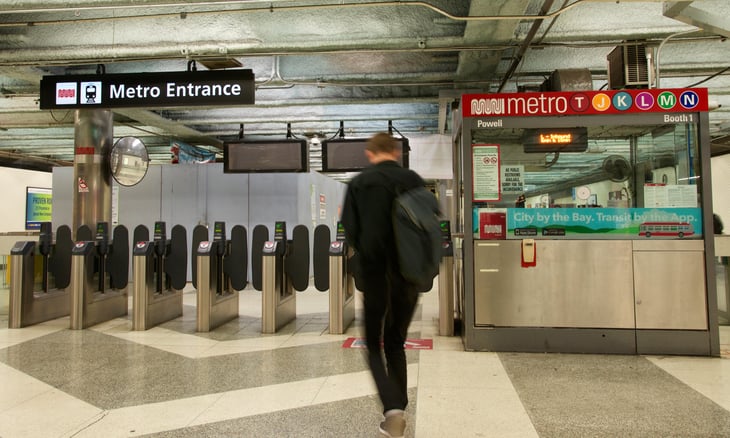
Transit Score: 80.4/strong>
Population: 805,235
The city’s iconic cable cars are the least of San Francisco’s rich public transportation network. Besides Muni buses, trains, cable cars and streetcars that connect the city’s neighborhoods, the Bay Area Rapid Transit (BART) elevated and subway trains connect the city with Oakland and the East Bay, the CalTrain commuter rail line connects the city with the San Francisco Bay Peninsula cities to the south, and ferries ply the waters between the city, Oakland and Sausalito. The Powell Street Muni station is shown above.
1. New York, New York

Transit Score: 85.3
Population: 8,175,133
In 2016, New York’s Metropolitan Transportation Authority opened the new 34th Street-Hudson Yards Station, extending subway service for the first time in 26 years. New York is known for its public transportation, with bike-share programs and many miles of bike lanes as well as buses, subway lines and the Long Island Rail Road. Since the city is so densely populated with block after block chock-full of services, many New Yorkers live their entire lives without owning a car.
How is the public transportation in your area? Share with us in comments below or on our Facebook page.
Add a Comment
Our Policy: We welcome relevant and respectful comments in order to foster healthy and informative discussions. All other comments may be removed. Comments with links are automatically held for moderation.